Hurricane Simon Mexico 2026 hits Category 4 with 250 km/h winds
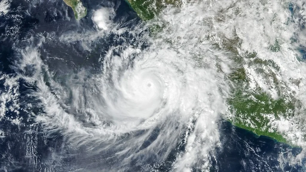
NASA’s Earth Observatory captured Simon near the Mexican coast as a Category 4 storm, with an uncertain path that could push it toward the Gulf of California.
Hurricane Simon reached Category 4 with 250 km/h winds near the Mexican coast on Oct 11, 2026.
NASA’s VIIRS satellite images and data from NHC indicate the storm's eye was offshore, with heavy rain and flooding likely for coastal areas.
Forecasts show the system may steer north and into the Gulf of California, but confidence is low and the path could change.
Residents should monitor local advisories and prepare for rain, flooding, and coastal hazards, as topography can amplify storms near shore.
Quick read · 1 min
NASA’s Earth Observatory captured Hurricane Simon near Mexico’s Pacific coast as a powerful Category 4 storm. The eye was offshore between Manzanillo and Puerto Vallarta, with winds near 250 km/h. Forecasters say the storm could move toward the Gulf of California, but the track is uncertain. Heavy rain and coastal swells are expected in the coming days.
What this means for everyday readers: plans to travel or ship goods in the Pacific region could be affected. Monitor official advisories and be ready for rain, floods and possible power outages. NASA will keep sharing satellite imagery as the storm evolves.
Track alerts and potential landfall shifts
Prepare for heavy rain and floods
Secure outdoor items and stay informed
Hurricane Simon sits near Mexico’s Pacific coast as a powerful Category 4 storm, with its eye about 50 kilometers offshore between Manzanillo and Puerto Vallarta. The storm reached sustained winds of 250 kilometers per hour at its peak, and forecasters warned that heavy rain and floods could affect coastal communities in the coming days.
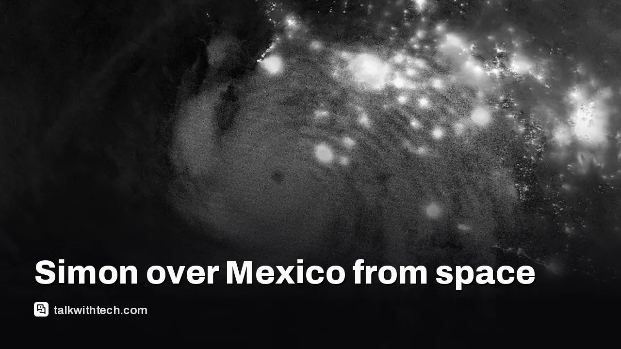
NASA’s VIIRS satellite captured imagery of Simon on Oct 11, showing an intense core and bands wrapping into the storm. The imagery also highlighted atmospheric gravity waves radiating from the storm’s eyewall, a sign of the strong convection pushing air upward. Forecasters note the mountains of the Sierra Madre can temper the storm’s intensity and shrink its wind field, but that doesn’t lessen the risk to nearby towns below.
As of the latest advisories, the storm’s path remains uncertain. The National Hurricane Center says Simon could drift toward the Gulf of California, potentially affecting areas well inland from the coast. Large swells and dangerous nearshore conditions are expected along portions of western Mexico in the days ahead, regardless of whether the storm makes landfall directly.
What makes Simon notable for readers in the United States, the United Kingdom and Canada is the potential ripple effect. Even if the core misses land, outer bands can bring heavy rain, flash floods and road closures to nearby states or stateside ferry routes in some cases. The exact track could influence shipping lanes, oil platforms, and tourism along the Pacific coast of Mexico, with downstream effects on travelers and supply chains that touch American markets.
NASA’s Earth Observatory notes that the nighttime VIIRS snapshot also shows how upper-atmosphere gravity waves appear as ripples in airglow when latent heat drives strong convection. These subtle signals help scientists understand how a storm evolves, even as its exact path remains uncertain.
01
What this means for everyday readers
For people in the U.S., this storm matters because it can shift weather patterns in the region and influence travel or shipping plans that cross the Pacific. If Simon intensifies or shifts west, it could bring heavier rain to parts of Baja California and northern Mexico, with residual moisture possibly spilling into southern California in some forecast scenarios. If you have friends or family in Mexico or traveling there, keep an eye on local advisories and airline updates.
Tips to stay prepared:
Check for local flood and weather advisories from official meteorological agencies.
Plan for heavy rain and possible road flooding; have essentials ready in case of short-term isolation.
Secure outdoor items and review insurance coverage for storm-related damage.
NASA’s data are helping scientists refine the storm’s evolution, but precise timing and landfall chances can still shift as Simon moves. Space-borne observations will continue to inform forecasts as the system evolves over the coming days.
Forecasters will update the track and intensity as Simon moves. If you are in the potential path, monitor local alerts and have a contingency plan for power outages and evacuation if advised by authorities.
Simon was a Category 4 storm near the Mexican coast on Oct 11, with sustained winds around 250 km/h, and its exact path remains uncertain.
Why is NASA involved in tracking this storm?
NASA uses satellites like VIIRS to monitor storms from space, helping scientists understand intensity, structure, and progression, which improves forecasts.